When a cyclone forms in the Bay of Bengal or the Arabian Sea, one question dominates the news: where and when will it make landfall? Landfall decides which districts get the strongest winds, the heaviest rain and the storm surge, and which areas need to evacuate. Yet the landfall point in IMD's bulletins often moves from one day to the next.
In November 2026, for example, the India Meteorological Department (IMD) first expected Cyclone Akvan to cross the coast between Nellore and Tuni, then between Nellore and Visakhapatnam, and finally between Narsapur and Puri, close to Gopalpur in Odisha. This guide explains what landfall actually means, what happens before and after it, and why the forecast changes.
What Is Cyclone Landfall?
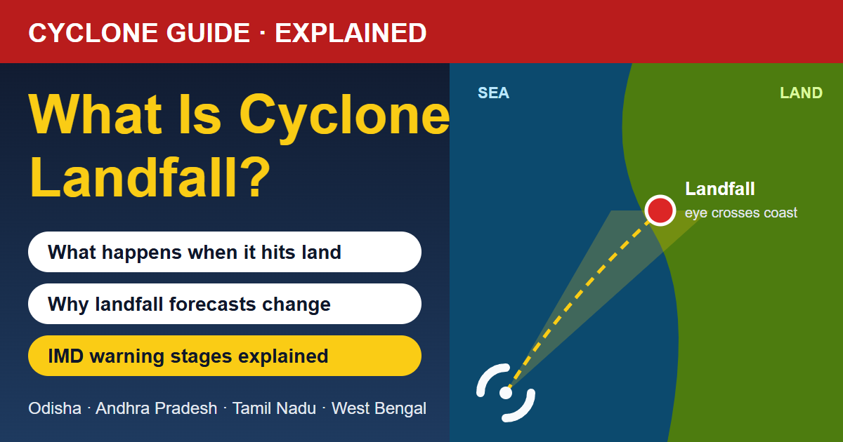
Landfall is the moment when the centre of a cyclone, its eye, crosses the coastline and moves from the sea onto land. IMD usually describes it as the cyclone "crossing the coast" between two places, for example "between Narsapur and Puri, close to east of Gopalpur, by noon of 20th November", along with the expected maximum sustained wind speed and gusts at that time.
It is important to understand that landfall is about the centre of the storm. A cyclone is not a single point. Its strong winds and rain bands can spread over an area a few hundred kilometres wide, so coastal districts feel its effects long before the eye arrives.
The Landfall Process: It Takes Hours, Not Minutes
IMD often talks about the landfall process. It begins when the cyclone's outer wall cloud, the ring of the strongest winds around the eye, first touches the coast, and it ends when the whole eye and the opposite wall have moved over land. Depending on the size and speed of the storm, this can take a few hours.
- 12–24 hours before: rain bands reach the coast, the sea becomes very rough and winds pick up. Storm surge starts to build.
- As the first eyewall arrives: the strongest winds and heaviest rain hit. This is often the most destructive phase.
- When the eye passes overhead: the wind may suddenly drop and the sky can even clear. This lull is dangerous because people think the storm is over.
- As the second eyewall arrives: violent winds return from the opposite direction, often catching people outdoors.
What Happens After Landfall?
A cyclone is like an engine that runs on warm, moist sea air. Once it moves over land:
- Its fuel is cut off: there is no warm ocean below to supply heat and moisture.
- Friction slows it down: hills, trees and buildings make the land surface much rougher than the sea, which weakens the winds.
So most cyclones weaken quickly after landfall, usually becoming a depression and then a low pressure area within a day or two. For Cyclone Akvan, IMD expected it to weaken from a severe cyclonic storm at landfall to a deep depression by the same evening and to a well-marked low pressure area by the next morning.
But weakening does not mean the danger is over. The remnant system can carry moisture hundreds of kilometres inland and cause very heavy rain, river flooding and landslides in hilly areas. That is why IMD often issues rain warnings for inland states such as Telangana, Chhattisgarh, Jharkhand and Madhya Pradesh after a cyclone hits the east coast. Learn more in our guide on what a low pressure area is.
Why Does the Landfall Forecast Keep Changing?
People sometimes see a changing landfall point as a forecasting mistake. In reality, it is how cyclone forecasting is meant to work. Here is why the forecast shifts:
- Steering winds change: a cyclone does not move on its own. It is pushed by the large-scale winds around it, such as high pressure ridges and troughs in the upper atmosphere. If these patterns shift, the track shifts too.
- Slow-moving storms are harder to predict: when the steering winds are weak, the cyclone drifts slowly, and small changes can turn it in a different direction. Akvan moved at only about 3 km/h on 18 November before speeding up to about 12 km/h the next day, and its forecast landfall moved north during this time.
- Small angles make big differences: India's east coast runs at an angle. A small change in the direction of a cyclone's track can move the landfall point by a hundred kilometres or more along the coast.
- Forecasts improve as the storm gets closer: as the cyclone approaches, forecasters get more data from satellites, coastal Doppler weather radars, ships and buoys, so the forecast becomes sharper with each bulletin.
IMD shows this uncertainty with a cone of uncertainty on its track maps: the cone is narrow for the next few hours and widens further into the future. The actual landfall point can fall anywhere inside the cone, which is why areas on both sides of the forecast point are warned.
Which Side of the Landfall Point Is Worse?
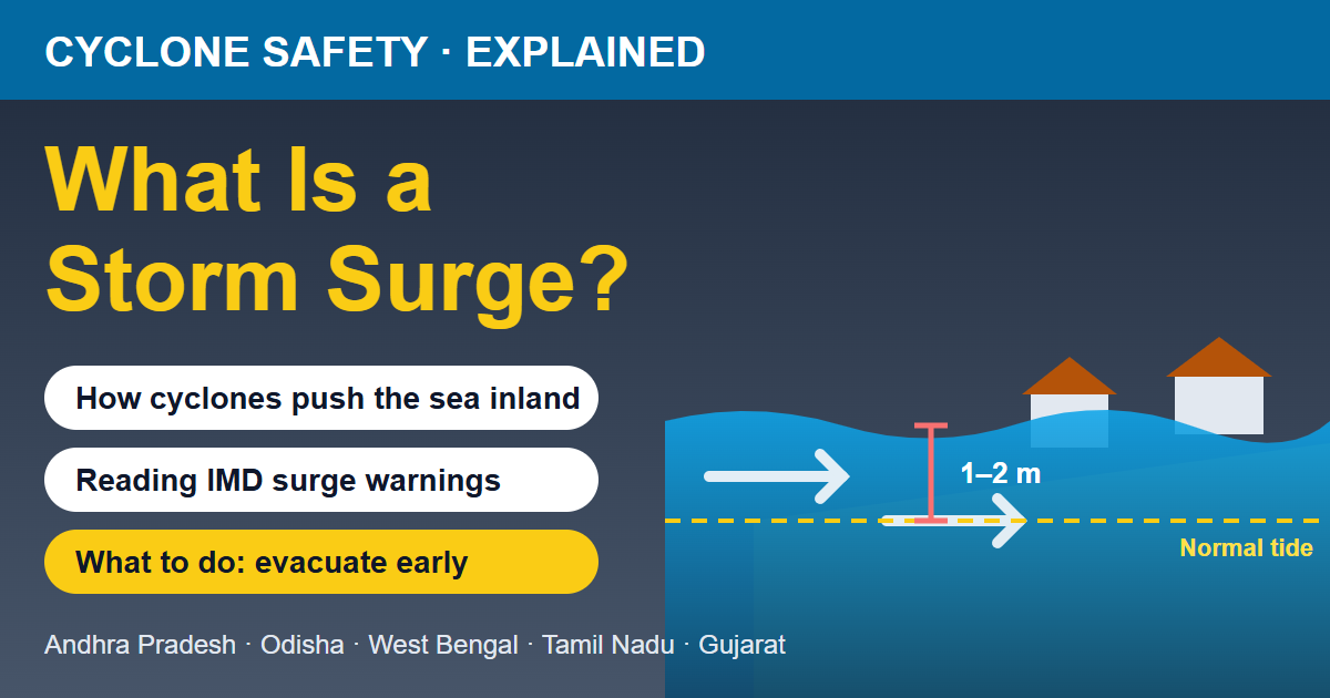
Cyclones in the Northern Hemisphere spin anticlockwise. For a cyclone moving north or north-west towards India's east coast, the winds on the right side of the track blow from the sea onto the land and also add to the storm's forward speed. That side usually gets the strongest winds and the highest storm surge, so areas just north or north-east of the landfall point often suffer the most. Read more about this in our explainer on what a storm surge is.
How to Read IMD's Cyclone Warning Stages
IMD issues cyclone warnings for India's coast in stages, getting more urgent as landfall comes closer:
- Pre-Cyclone Watch: issued when a depression or cyclone may affect the coast, usually about 72 hours in advance.
- Cyclone Alert: issued about 48 hours before adverse weather is expected to start over coastal areas.
- Cyclone Warning: issued about 24 hours before the start of adverse weather, with details of the expected landfall point, wind, rain and storm surge.
- Post-Landfall Outlook: issued about 12 hours before landfall, describing what inland areas can expect after the cyclone crosses the coast.
The most serious bulletins carry a "Red Message" label. IMD issued a Red Message for the north Andhra Pradesh and south Odisha coasts on 19 November 2026 for Cyclone Akvan. To understand the colour codes in IMD's weather warnings, read IMD alert colours explained. A red colour warning means take action, not just stay alert.
Famous Cyclone Landfalls in India
- Cyclone Phailin (October 2013) made landfall near Gopalpur in Odisha. Accurate track forecasts and the evacuation of a very large number of people helped keep the loss of life far lower than in earlier storms of similar strength.
- Cyclone Hudhud (October 2014) crossed the coast at Visakhapatnam, causing heavy damage to the city's trees, power lines and buildings.
- Cyclone Fani (May 2019) made landfall near Puri as an extremely severe cyclonic storm, and timely evacuations again saved many lives.
Other places that often come under cyclone watch include Bhubaneswar, Kakinada, Machilipatnam, Chennai, Digha and, on the west coast, Dwarka.
What Should You Do When Landfall Is Near Your Area?
- Do not wait for the landfall time. Strong wind, heavy rain and storm surge can arrive many hours earlier. Follow evacuation orders as soon as they are given.
- Stay indoors during the lull. If the wind suddenly stops, the eye may be passing over you. Wait for officials to confirm the storm has passed.
- Prepare for power and network cuts. Charge phones and power banks, keep a torch, drinking water, dry food, medicines and documents in a waterproof bag.
- Stay alert after landfall. Rivers can rise for a day or two after the cyclone has weakened, and fallen power lines and damaged buildings remain dangerous.
- Follow only official updates from IMD and your district administration, and ignore forwarded rumours.
For a full checklist, read our guide on cyclone safety tips: what to do before, during and after a cyclone, and our explainer on cyclone formation, categories and naming.
Final Word
Landfall is the moment a cyclone's centre crosses the coast, but its impact starts well before and continues well after that point. When IMD changes the expected landfall location, it is not a sign that the forecast is unreliable; it is the forecast getting sharper as more data comes in. If your district is anywhere near the forecast cone, prepare early and follow official advice. Track the latest weather news and the hourly forecast for your town on TodayWeather whenever a cyclone is moving towards India's coast.