When a cyclone approaches the coast, most people worry about the wind. But the deadliest part of a cyclone is often the sea itself. A storm surge can push sea water several metres above normal and send it kilometres inland in a few hours, flooding villages, fields and roads before the strongest winds even arrive.
In November 2026, for example, the India Meteorological Department (IMD) warned that Cyclone Akvan could bring a storm surge of 1 to 2 metres to low-lying parts of six Andhra Pradesh districts at landfall. This guide explains what such a warning actually means.
What Is a Storm Surge?
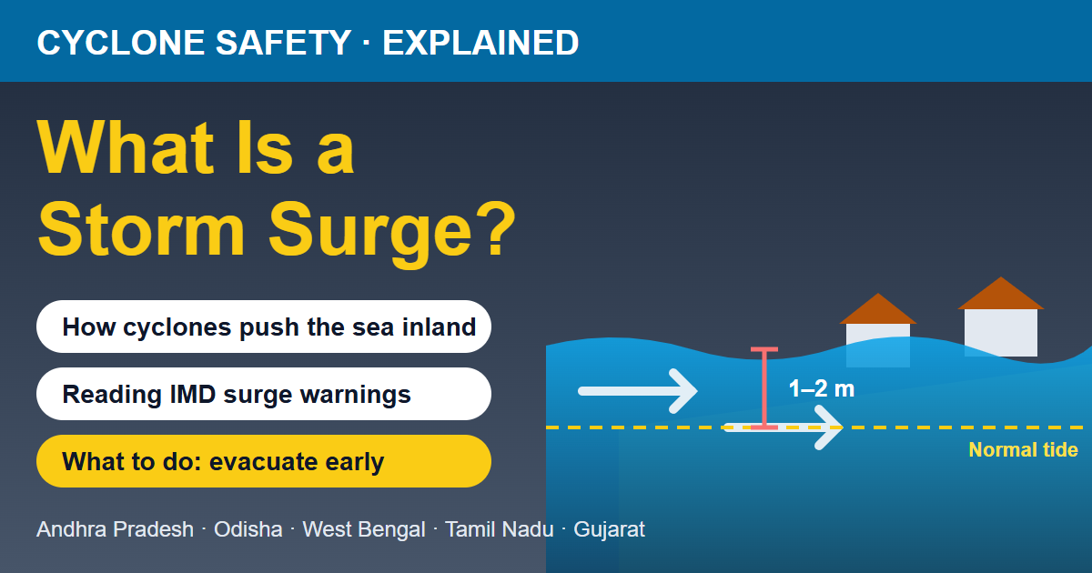
A storm surge is an abnormal rise in sea level caused by a cyclone. It is measured as the height of the water above the normal tide that would have occurred at that time. If IMD forecasts a "storm surge of 2 m above astronomical tide", it means the sea is expected to stand about 2 metres higher than it would on a normal day at that hour.
The surge is not one big wave. It is more like the whole sea level rising for several hours, with normal wind waves riding on top of it. That is why it can flood large areas and why it is so hard to escape once it starts.
How Does a Storm Surge Form?
Three things work together:
- Wind pushing water: This is the main cause. A cyclone's strong winds blow over the sea for hours and drag the water along with them. As the cyclone nears the coast, this water piles up against the shore with nowhere else to go.
- Low pressure lifting the sea: Air pressure at the centre of a cyclone is much lower than normal, so the sea surface under it bulges upward slightly. This adds a smaller part of the surge, roughly 1 cm for every 1 hPa drop in pressure.
- Shape of the coast and sea floor: A shallow sea near the coast stops the water from spreading downward, so it rises higher. Bays, river mouths and deltas funnel the water and make the surge even higher.
If the surge arrives at high tide, both add together and the flooding is much worse. Heavy rain from the same cyclone can also swell rivers at the same time, so the sea pushes in while the rivers are trying to drain out.
Why Is India's East Coast So Exposed?
The Bay of Bengal produces more cyclones than the Arabian Sea, and many of them make landfall on the east coast. Much of this coast has a wide, shallow continental shelf and flat, low-lying deltas, such as the Godavari and Krishna deltas in Andhra Pradesh, the Mahanadi delta in Odisha and the Sundarbans in West Bengal. Shallow water makes the surge taller, and flat land lets it travel far inland.
History shows how dangerous this can be. Storm surge was a major cause of loss of life in the 1977 Andhra Pradesh cyclone that struck the Krishna delta near Diviseema, and in the 1999 Odisha super cyclone, when surge water flooded large parts of the coast. Since then, early warnings, cyclone shelters and timely evacuation have saved thousands of lives, which is exactly why surge warnings must be taken seriously.
Places that often come under cyclone and surge watch include Machilipatnam, Bapatla, Kakinada and Visakhapatnam in Andhra Pradesh, Puri, Gopalpur and Balasore in Odisha, Digha in West Bengal and Chennai in Tamil Nadu. The west coast, including Gujarat's Saurashtra and Kutch coast around Dwarka, can also see surges when Arabian Sea cyclones make landfall.
Where and When Is the Surge Highest?
- Near landfall: The surge peaks around the time the cyclone's centre crosses the coast and shortly after.
- On the onshore-wind side: The surge is highest where the cyclone's winds blow from the sea onto the land. In the Northern Hemisphere, cyclones spin anticlockwise, so for a cyclone moving towards India's east coast from the Bay of Bengal, this is usually the area to the right of the track, often just north of the landfall point.
- In shallow bays and river mouths: Water gets squeezed and rises higher.
- Stronger and bigger cyclones: More wind over a larger area pushes more water. A slow-moving cyclone can also push water for longer.
This is why IMD names specific districts and even the hours of peak surge in its warnings. For Cyclone Akvan, IMD said the peak surge was expected over Bapatla, Krishna and West Godavari districts from the morning to the afternoon of landfall day.
How to Read IMD's Storm Surge Warning
IMD's cyclone bulletins include a separate Storm Surge Warning line. It usually tells you:
- Height: for example, "1.0 to 2.0 m above astronomical tide".
- Area: the districts whose low-lying areas may be flooded.
- Timing: when the surge is expected to begin, peak and ease.
Even a surge that sounds small is dangerous. Just 15 cm of fast-moving water can knock an adult off their feet, and around 60 cm can float and sweep away a car. A 1–2 m surge can flood ground-floor homes, wash away huts and boats, and turn farmland salty for months. Learn more about how cyclones are graded in our explainer on cyclone formation, categories and naming, and about warning colours in IMD alert colours explained.
Storm Surge vs Tsunami vs High Tide
- Storm surge: caused by a cyclone's winds and low pressure. Forecast days ahead, builds over hours, comes with strong wind and rain.
- Tsunami: caused by an undersea earthquake or landslide. Can arrive on a calm, sunny day with very little warning.
- High tide: the normal daily rise of the sea caused by the moon and sun. It is predictable and usually harmless, but a surge on top of a high tide is the worst case.
What to Do If Your Area Is Under a Storm Surge Warning
Before the cyclone
- Find out whether your home is in a low-lying coastal area and where the nearest cyclone shelter or strong building on higher ground is.
- Pack an emergency bag: ID and important documents in a waterproof cover, medicines, drinking water, dry food, a torch, a charged phone and power bank, and some cash.
- Move boats, nets, livestock and stored grain to higher ground early.
- Evacuate as soon as the administration asks. Do not wait until the wind picks up, because surge water can cut off roads before the cyclone's centre arrives.
During the cyclone
- Stay in the shelter or on an upper floor. Never go to the beach or a jetty to watch the sea.
- Do not walk or drive through flood water. It may be deeper than it looks and can hide debris and open drains.
- When the eye passes, the wind may stop for a while. This is not the end. Winds return from the opposite direction and can push water again.
After the cyclone
- Return home only when officials say it is safe. Surge water can weaken roads, embankments and building foundations.
- Stay away from fallen power lines and switch off the main supply before re-entering a flooded house.
- Drink only boiled or treated water, as wells and hand pumps may be contaminated with sea water and sewage.
- Farmers should drain sea water from fields as soon as possible and seek advice from the local agriculture office on dealing with salty soil.
For a complete checklist, read our guide on cyclone safety tips: what to do before, during and after a cyclone.
Final Word
A storm surge is the cyclone hazard that people most often underestimate, because it does not look dangerous until the water is already rising. The good news is that it is forecast in advance. If IMD's bulletin names your district in a storm surge warning, treat it as a signal to move to safety early. Keep an eye on the latest weather news and the hourly forecast for your town on TodayWeather whenever a cyclone is forming in the Bay of Bengal or the Arabian Sea.