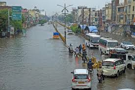
Washington, D.C., August 10, 2026: A fresh round of heavy rain and thunderstorms is threatening parts of the Upper Midwest and Great Lakes, with forecasters warning that repeated downpours could increase the risk of localized flash flooding. The NOAA Weather Prediction Center has placed portions of the Upper Great Lakes and Upper Mississippi Valley under a Slight Risk of excessive rainfall for August 10.
The broader National Weather Service outlook also highlights a corridor of heavy rainfall and severe thunderstorms from the Midwest toward the Lower Great Lakes and Ohio Valley, with the threat continuing into the next phase of the week.
Minnesota Rain Alert: Heavy Storms Could Bring Local Flooding
Minnesota is one of the key states to monitor as thunderstorms move across the Upper Mississippi Valley.
Periods of heavy rain can become particularly problematic where storms repeatedly track over the same communities. Urban areas, low-lying roads and locations near small streams may see water rise quickly during stronger downpours.
Residents in Minneapolis, St. Paul, Rochester, Duluth and surrounding communities should monitor local National Weather Service warnings and radar through the day.
A broad risk outlook does not mean every city will experience flash flooding, so local warnings remain the most important source for immediate action.
Wisconsin Weather Alert: Repeated Downpours May Raise Flood Risk
Wisconsin also lies within the broader Upper Midwest heavy-rain corridor.
Storms capable of producing intense rainfall may affect parts of the state, and localized flooding can develop where drainage systems are overwhelmed or where the ground is already wet.
People in Milwaukee, Madison, Green Bay, Eau Claire and La Crosse should track local radar and short-term forecasts, especially if thunderstorms begin training over the same area.
Drivers should never assume that water covering a roadway is shallow enough to cross safely.
Michigan Rain Update: Great Lakes Region Under Watch
Michigan is another state to watch as the weather system affects the Great Lakes region.
Heavy thunderstorms moving into or near the state could produce locally intense rainfall, reduced visibility and temporary travel disruptions.
Weather conditions may differ significantly between Detroit, Grand Rapids, Lansing, Ann Arbor and northern Michigan, so statewide headlines should not replace city-level forecasts.
The National Weather Service's broader outlook notes that the heavy-rain threat extends through the Great Lakes and toward the Ohio Valley.
Iowa Rain Alert: Storms Could Produce Heavy Downpours
Parts of Iowa may also be affected by the same storm corridor.
Strong thunderstorms can produce a large amount of rain over a short period, raising the risk of street flooding and rapidly rising small streams.
Residents of Des Moines, Cedar Rapids, Davenport, Waterloo and Ames should monitor local watches and warnings if storms intensify.
The highest flood threat will depend on exactly where the strongest storm clusters develop.
Illinois Weather: Heavy Rain Threat Could Shift East
As the system moves eastward, parts of Illinois may also see rounds of thunderstorms and heavy rainfall.
The NWS national outlook indicates the broader severe-weather and heavy-rain threat will shift from the Midwest toward the Ohio Valley and Central Appalachians.
For cities such as Chicago, Rockford, Peoria, Springfield and Champaign, local forecasts should be checked regularly because timing and rainfall intensity can change as storm complexes develop.
Ohio Valley Weather Alert: Rain Threat May Increase
The heavy-rain pattern is expected to progress toward the Ohio Valley.
That puts parts of Indiana, Ohio, Kentucky and nearby states on the radar for later rounds of thunderstorms and locally heavy rainfall.
Heavy rainfall in urban areas may lead to temporary street flooding, while rural areas can see rapid rises in creeks and small rivers.
Forecast confidence improves closer to the event, so residents should keep checking updated local advisories.
Flash Flood Risk: Why the Upper Midwest Is Important Today
NOAA's Excessive Rainfall Outlook does not forecast a guaranteed flood at a specific location. Instead, it highlights areas where rainfall may exceed local flash-flood guidance within a certain distance of a point.
For Aug. 10, the WPC outlook identifies a Slight Risk across portions of the Upper Great Lakes and Upper Mississippi Valley, making this region one of the main U.S. rainfall areas to monitor.
The exact placement of the heaviest rain can still change as thunderstorms evolve.
Severe Thunderstorms May Accompany Heavy Rain
The flood threat is not the only concern. Strong thunderstorms can also produce:
People should follow local NWS warnings if a Severe Thunderstorm Warning or Flash Flood Warning is issued for their area.
What Drivers Should Do During Heavy Rain
Never drive through a flooded roadway when the water depth is unknown. Flash flooding can develop rapidly, especially on:
If water is flowing across a road, turning around is safer than attempting to cross.
Drivers should also reduce speed during intense rain because visibility and tire traction can deteriorate quickly.
US Weather Outlook: Heavy Rain Threat May Shift East
The current weather pattern is expected to evolve over the next few days.
The National Weather Service indicates the heavy-rain and thunderstorm threat will move from the Midwest and Great Lakes toward the Ohio Valley, Central Appalachians and eventually parts of the eastern U.S.
That means the states with the highest rainfall concern can change from day to day.
TodayWeather users should therefore monitor local forecasts rather than relying on one national headline throughout the week.
TodayWeather Advisory
Residents across Minnesota, Wisconsin, Michigan, Iowa, Illinois and nearby states should keep local weather alerts enabled and monitor radar if thunderstorms begin developing.
A national excessive-rainfall outlook identifies areas of elevated risk, but Flash Flood Warnings and local NWS alerts are the signals that require immediate attention.